A summering environmental perspective.
At summertime the call of shorelines, any shoreline, becomes irresistible, consistent with the season’s sensual ambiance.
Together with this sensorial aspect comes an intuitive one, a subtle message, picked up by some poets and philosophers that makes us aware that, at any shoreline, the piece of earth we are standing on feels like an island.
In other words, at the shoreline, we sense our own limited earth settler condition regardless of the magnitude of the water body. (see feature sketch)
I wish to delve into elements that speak of the whole city and its interconnected parts as they relate to the larger landscape, as part and parcel of the mental image we have of the city we inhabit.
How does it lay on the land, where does it stop, how do we enter it, how do we circulate hierarchically from local street to trans-urban throughway to regional highway, how do we organize our itineraries as so many circuits and so many orienting landmarks and high points, how are the city’s parts characterized, etc., all of which is information critical to our functioning in the urban environment and to our sense of belonging to its social body.
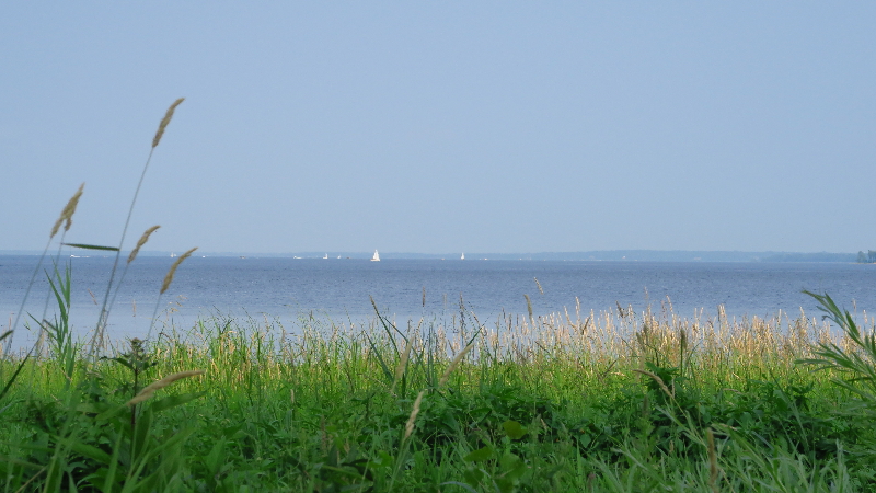
Take the “lake” shoreline shown above that is actually a spectacular widening of the Ottawa river, before it joins the St Lawrence river’s own widening at the west end of the island of Montreal; this geographically defined twin water body looms big in the citizen’s mental image of the general location, means of access to and exit from, and general organization of the city and its suburbs.
What I hope to do in this series is to find, document and discuss elements of the landscape and of the cityscape which, in various situations, nurture our abilities to understand the organization of our environment, at a larger scale than used so far in my posts.
These elements of landscape and cityscape orient us to the limits and to the linkages between them, to contrasts of occupancy, to historical and geographical continuities and breaks, etc. all represented in our mental image of the urban environment we inhabit.
Limit as element of the landscape
The shoreline, whether experienced directly as shown below, or indirectly as from coastal roads lined with buildings and left over wooded areas, is an important element of the environmental organization we need to have an adequate mental image of, if only to know where the land ends and the water begins…THE limit.
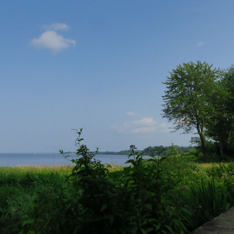
It brings to the fore such natural and cultural phenomena as marshland, fowl reserve, beach and marina, fishing piers private and public in the summer, and in winter, public access to the ice bridge leading to winter fishing holes, shore hugging cross country skiing trails, etc.
It does allow for a wide angle view of the opposite distant shore of the lake, with its village and suburban settlements and their church steeples as foremost indicators of human-social occupancy … and it does remind one, quite evidently, of the ferry linking these “lake” shores, and of its landings on same shores, particularly as alternative to a lengthy highway roundabout to go from one shore to the other across bridges spanning the water between the previously mentioned islands.
From marshland to lake, to ferry, and to highway network is an example of the complexity of our mental image nurtured by the variety of experiences of the cityscape and its contextual landscape.
Without these numerous, varied and repeated experiences, a paper or GPS map will be needed to support a limited mental image of the landscape around the city.
Linkage as element of the cityscape
Between the old historical core of the city and its northern expansion lies a commercial zone, being the first zone of expansion. This area has a different scale than the old city core with its three or four stories buildings hugging each other elbow to elbow.
We can penetrate, if we have business there, this transitional linkage zone via a mid bloc alley the ends of which are marked at each bloc’s ends with tunnel like portals to accommodate large trucks for servicing, away from fronting streets.

We are here essentially at a medium scale of representation that requires one to be aware of the particular street geometries of the areas in contact; these are as, in this case, made more “imageable” by a topography that places this tunnel entrance at mid-slope.
Looking into this circulation and building back-space we find another order and scale and form of things: instruments of work, service vehicles, utilitarian façade treatment, exterior fire escape stairs … and a tree hanging its branches over the wall of its courtyard location. All intimations of an urban interior domain kept away from public view. An attention to certain hierarchies lacking in today’s point buildings that use streets for ceremonial and service access indiscriminately.
Walking that slope allowed me to stop, look, ponder and document the scene … and remember its continuation, in another city bloc, as an exterior social hall for the International Hotel where we had hosted an EDRA conference social event in the late nineties. Here is an example of a particular type of urban space accommodating many functions as it links the old city to its northern extension.
Discussion
I have, in the past, paraphrased professor Donlyn Lyndon’s view on what constitutes a “good place”: stimulating and information rich, formally memorable, accessible and accommodating of various uses and users, flexible to change across time and generous in spatial extent making it evocative of human presence, easy to understand and supportive of activities.
Can a city be considered a “place” that we may use such criteria to appreciate its “goodness”?
My intention here, is closer to the late Victor Steinbrueck’s in his “Seattle cityscape,” which was to delineate the “image of a city” using “sketches and thoughts”:
“Pictures and sketches can only suggest, although perhaps by their very brevity, essentiality, and generality they may allow the observer to participate more fully in the experience of knowing and comprehending the city.” (p. 27)
What and how I will observe, sketch, photograph and comment will be influenced by Grady Clay’s approach described in his classic “Close- up, How to read the American city”, as one that seeks to understand the city as process.
“A city is not as we perceive it to be by vision alone, but by insight, memory, movement, emotion, and language. A city is also what we call it and becomes as we describe it. (…) We must watch for the before and after, the goings on as well as the objects themselves.” (p.27)
Back now to summering and reporting.
Bibliography:
Clay, Grady: Close-Up, How to Read the American City, 1973, Univ. of Chicago Press, Chicago
Steinbrueck, Victor: Seattle Cityscape, 1962, Univ. of Washington Press, Seattle
Sketch and photos credit Maurice Amiel